
AI-Powered Archaeological LiDAR Analysis Tool
Micro-SaaS
Desktop software that detects archaeological features in LiDAR terrain data in minutes, for heritage services, archaeology firms and researchers
Published on
October 22, 2026

$7,500
Asking Price
Main Metrics
$2,900
ARR
5
Customers
2026
Launched
$7,500
Asking Price
Already Sold
Main Metrics
$2,900
ARR
5
Customers
2026
Launched
Overview
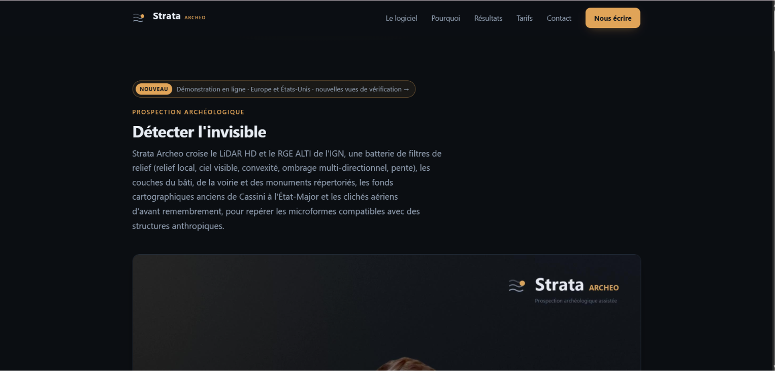
<p>My product is a Windows desktop software that finds archaeological features hidden in LiDAR terrain data. You draw an area on a map; in a few minutes, the tool downloads the elevation model, analyses the micro-relief and returns a ranked list of likely man-made features: barrows, castle mottes, enclosures, hillforts, hollow ways, Roman roads, fossil field systems, charcoal platforms. Each one comes with its measurements, cross-sections, verification views and coordinates, and is cross-checked against databases of already known sites. A PDF report and GIS exports (GeoPackage, Shapefile, GeoJSON) are generated automatically.</p><p>Unlike black-box AI tools, my product uses explicit, documented geometric rules, which archaeologists can check and cite. Measured on 177 protected monuments over 63.9 km² of French LiDAR HD, without giving the software their positions: 75% of barrows and 70% of castle mottes detected.</p><p>I started it in 2026 as a solo founder, after seeing that the new national LiDAR datasets were far too large for archaeologists to review by eye. France is natively covered (IGN LiDAR HD, automatic download); Italy has its own edition (regional LiDAR, 1954 aerial photos, historical cadastres, 13,500 known sites); other countries work with the user's own LiDAR files.</p><p><b>Key highlights:</b></p><ul>
<li>Revenue: €2,500 from 5 licences sold since launch (August 2026)</li>
<li>Profit: ≈ €2,400 (running costs ≈ €100/year: domain + business email)</li>
<li>Pricing: perpetual licence per seat, €500 (Standard) or €1,200 (Full), optional 20%/year maintenance</li>
<li>Churn / LTV / CAC: too early to measure (first customers in 2026; acquisition by direct email only, CAC ≈ €0 in cash)</li>
<li>Margin: ~96% (software licence, no paid infrastructure)-</li>
<li>Product: complete and shipping (installer, demo edition, online demo, website in 11 languages).</li>
</ul>
<p><b>Team</b></p><p>Solo founder. Product design, development, website, sales outreach, and customer support. No employees, no contractors, no ongoing commitments transferred to the buyer.</p><p><b>Tech Stack</b></p><ul>
<li>Python (NumPy, SciPy, rasterio, pyproj): analysis engine, terrain processing, detection rules, PDF reports, GIS exports</li>
<li>FastAPI: local server inside the desktop app</li>
<li>JavaScript, HTML/CSS, Leaflet: user interface and map</li>
<li>PyInstaller + Inno Setup: Windows installer, built automatically with GitHub Actions (full and demo editions)</li>
<li>Cloudflare Pages: website and online demo; Cloudflare R2: installer downloads</li>
<li>Data sources: IGN Géoplateforme (France), Italian regional LiDAR services and TINITALY, OpenStreetMap / Wikidata for known sites.</li>
</ul>
<p>Automated test suite (several hundred tests). No paid third-party services or subscriptions required.</p><p><b>Marketing and growssth</b></p><p>Growth so far has been direct outreach only, no advertising:</p><ul>
<li>August 2026: personalised emails to ~70 French archaeology services, firms and researchers, followed by a second wave in October with the demo.</li>
<li>October 2026: ~200 personalised emails in 9 languages to heritage services, archaeology companies and universities in 14 countries (Germany, Italy, Spain, UK, US, Poland, etc.).</li>
<li>Results: 5 sales, several qualified conversations, including a French mining-archaeology firm preparing a test, and an Italian LiDAR research team led by a leading landscape archaeologist.</li>
<li>Built-in conversion tools: a free online demo and a downloadable demo edition with locked features that invite users to upgrade.</li>
</ul>
<p>Untapped channels: SEO (the website is already in 11 languages), conferences, archaeology training courses, partnerships with GIS vendors, paid search.</p><p><b>Revenue and profitsss</b></p><ul>
<li>Revenue to date: €2,500 from 5 licences (Standard, €500 each), since launch in August 2026</li>
<li>Pricing: perpetual licence per seat: Standard €500, Full €1,200; optional yearly maintenance at 20% of the licence price; site licence for multi-office organisations from €4,000</li>
<li>Running costs: ≈ €100/year (domain ≈ €15/year, business email ≈ €85/year). Hosting (Cloudflare Pages + R2) and code hosting (GitHub) are free tiers</li>
<li>Profit to date: ≈ €2,400</li>
<li>MRR / ARR: no recurring revenue yet; maintenance contracts are the natural next step</li>
</ul>
<p>Very early stage: the numbers show market validation (people pay €500 for it), not yet a stable revenue stream.</p><p><b>Return on investment</b></p><p>At an asking price of €6,500, the buyer breaks even with 13 Standard licences, or about 5 Full licences, or 2 site licences. For comparison, 5 licences were sold in roughly two months with no advertising and only part-time effort. Fastest paths to payback: follow up the 270+ prospects already contacted (several replied positively), raise prices after the launch period as planned (Standard €750, Full €1,800), and sell yearly maintenance. A buyer with an existing customer base in archaeology, forestry or GIS can realistically recover the price within 6 to 12 months.</p><p><b>Startup assets</b></p><ul>
<li>Full source code (Python + JavaScript), with automated tests and documentation</li>
<li>Windows installers (full and demo editions), automated build pipeline</li>
<li>Domain and the website in 11 languages, including a live online demo</li>
<li>Brand</li>
<li>5 existing customers (perpetual licences already delivered; a maintenance offer can be proposed to them)</li>
<li>Prospect list: ~270 contacted organisations across 15 countries (heritage services, archaeology firms, universities), with conversation history</li>
<li>Bundled data: 13,500 known Italian archaeological sites, French protected monuments, country borders, regional typologies for 18 countries</li>
<li>Handover support: 4 weeks of help after the sale</li>
</ul>
<p><b>Risks</b></p><ul>
<li>Niche market: archaeology and heritage buyers are few and slow (public procurement). Mitigation: target companies and research labs first, and adjacent markets (forestry, environmental impact studies, GIS).</li>
<li>Early stage: limited revenue history. Mitigation: low asking price, low running costs, and handover support from the founder.</li>
</ul>
<p><b>Summary</b></p><p>My tool is a finished, working product in a niche with no direct low-cost competitor: archaeologists today review LiDAR by eye or with complex GIS workflows. It already has paying customers, a measured detection rate, a multilingual website and demo, an Italian edition, and a warm prospect list in 15 countries. Running costs are almost zero. A buyer with sales time, or an existing customer base in archaeology or GIS, can turn the groundwork already done into recurring revenue quickly.</p><p>✅ $2,900 TTM revenue</p><p>✅ 5 customers</p><p>✅ Business model: Licensing</p><p>✅ Built with JavaScript, Python, HTML</p>
$2,900
Annual Revenue
5
Number of Customers
Business Model
Perpetual licence per seat at €500 (Standard) or €1,200 (Full), with optional yearly maintenance at 20% and site licences from €4,000.
Target Audience
Archaeologists and heritage professionals working with LiDAR: archaeology firms, heritage services and research labs.
Asking Price Reasoning
A finished product with 5 paying customers, near-zero costs and 270+ warm prospects, priced at about 2.6x its revenue so a buyer can recover it with just 13 licence sales.
Reason for Selling
As a solo founder I no longer have the time to grow sales, and I want it to go to someone who can take it further.
Growth Opportunity
Convert the 270+ prospects already contacted in 15 countries, sell yearly maintenance and site licences, and add automatic LiDAR download for new countries.
30 days free support from seller
Competitors
Free visualisation tools (Relief Visualization Toolbox) and general GIS software (QGIS, ArcGIS Pro), which show the relief but leave archaeologists to find every feature by eye.
Tech Stack
JavaScript, Python, HTML, Fast API, Cloudflare, CSS, GitHub.
Traffic Metrics

Revenue Metrics

How it works

$7,500
Asking Price
Already Sold

Main Metrics
$2,900
ARR
5
Customers
2026
Launched

Profitable startups straight to your inbox
Join 10,000+ entrepreneurs and investors looking for their next startup acquisition opportunity.
Oops! Something went wrong while submitting the form.


